Utility System Mapping

Price Geographic Consulting 208-267-2975
- Price Geographic Consulting has years of experience in preparing highly accurate water and sewer system maps for Public Works Departments, Irrigation Districts, Community Services Districts, water suppliers, sewer disposal districts and private water system operators.
- PGC uses GPS data, CAD drawings, digital or paper systems maps, aerial imagery, topography (including Dem and LiDAR), databases, institutional knowledge and direct field observations to create a system wide digital network of water and sewer system infrastructure including water and sewer pipes, valves, manholes, services, pressure zones, customer databases, facilities maintenance software. After Digitizing attributes are input for each feature type or object, a map book is set up with dynamic attribute driven annotation, and digital and hardcopy maps are produced along with a desktop mapping set and mobile mapping set or use by system staff.

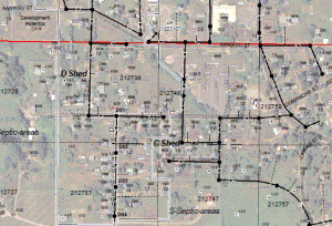
Detail of GIS sewer system layer with aerial photo and parcel background. - Price Geographic Consulting staff have over 20 years experience in designing water and sewer lines, plan preparation, construction staking, inspection, reparing as-built (record) drawings and managing CAD files and survey Data. his background uniquely prepares Price Geographic Consulting to provide GIS mapping of sewer and water systems, with the breadth of understanding necessary to impliment a well thought out and successfull Facilities Information System (FIS).

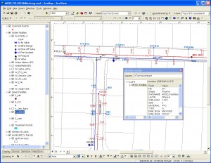
Water and sewer infrastructure viewed from within ArcMap GIS Software. Clic on Object to see a window with feature attributes.
