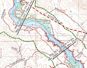
Inundation Mapping
- PGC uses the latest GIS and Cartographic techniques and technologies to create or update Inundation Maps for your high risk dam. The maps are made to satisfy your organizations needs, fullfil mapping requirements of FERC or other regulating agencies.
- PGC has access to extensive libraries of ready made basemapping for your project such as

Inundation Map developed with GIS software. current aerial imagery, GIS ready USGS topo maps, digital elevation models, roads, place names dam locations, citiy and county boundaries, parks, schools, hospitals, fire & police stations and many other layers.
- PGC has experience coordinating the mapping effort and content with Emergency Management Agencies (EMA’s) and providing flood and evacuation zones to Reverse 911, E911 and other Reverse emergency telephone notification systems.
- Price Geographic Consulting and Kessler & Associates prepare and update Emergency Action plans, and organize and conduct Table Top and Functional Exercises for dam operators and emergency response agencies and personnel

Dam failure flood zone overlayed on an oblique aerial image showing the effect on critical locations.