UAV (Drone) Mapping
Aerial Mapping, 3D Modeling, Photography & Video Services
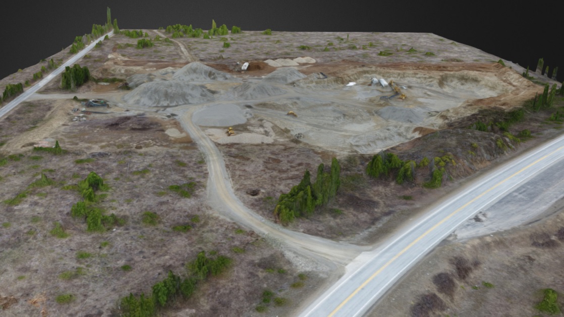
Price Geographic Consulting is now offering aerial imagery, video and 3D models collected using UAVs (Unmanned Aerial Vehicles, also know as Drones). Ultra high resolution and up to date imagery and models can be generated that are extremely cost effective. Drones can fly from ground level up to 400’ and capture detail and perspectives that are impossible with manned aircraft. Imagery and video can even be captured indoors! From Imagery to 3D Models to Volume Calculations to Real-time Monitoring, PGC has a custom drone mapping solution for you.
Industries:
Hydroelectric | Environmental | Mining | Agriculture | Forestry | Utilities | Water/Wastewater | Construction | Real Estate | Insurance | Inspections | Emergency Response | Law Enforcement | Fire Services
Products:
Ortho Photo Mosaics | Resolution from 1/2” to 1 Foot
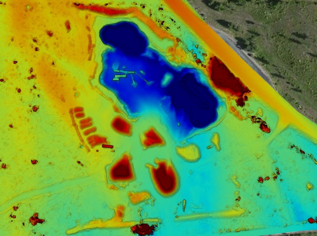
Digital Surface Models (DSM) | Surface including above ground features
Digital Terrain Models (DTM) | Model of terrain (ground)
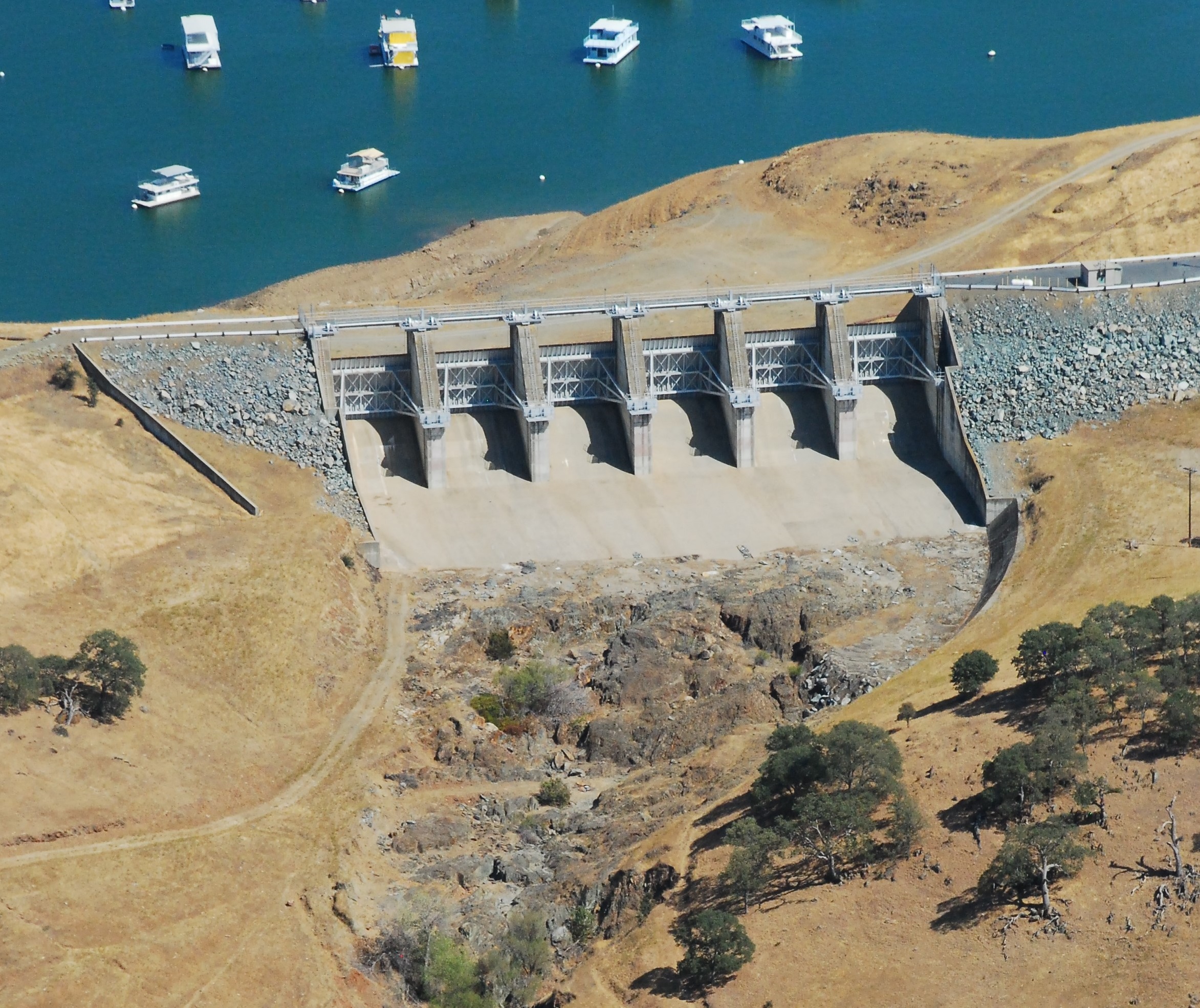
3D Virtual Inspection Models | Dams, structures, towers, poles
Contours and Volumetrics | Elevation data and volume calculations
Oblique Photography | Real Estate, infrastructure, events
3D Point Clouds | 3D Modeling
4K Video | Events, real estate, sports, inspections
Real-Time Monitoring | Situational Awareness, Surveillance